If we had found the North Island sparsely populated and having windy roads we were surprised to find the south island even more desolate and remote. As soon as we arrived we turned off the main road and were only to meet a handful of other cars on our way into Nelson the only place in New Zealand to have a climate similar to Mediterranean countries. So far in New Zealand we had been lucky as the winter had been very mild. This was soon to change once we arrived in the South Island as a colder front was on its way in. This meant snow and ice were to be a real possibility. During our time in the south island there was also a 6.6 magnitude earthquake at the northern tip of the south island of New Zealand. Thankfully during this time we were down the southern tip of the south island and were one of the only places not to feel the earthquake in the south island. The earthquake was serious enough to damage roads around the northern tip of the southern island and the capital Wellington, with trains and flights from here also being cancelled. Thankfully none of these affected us, but they would've done if it had happened just one week earlier.
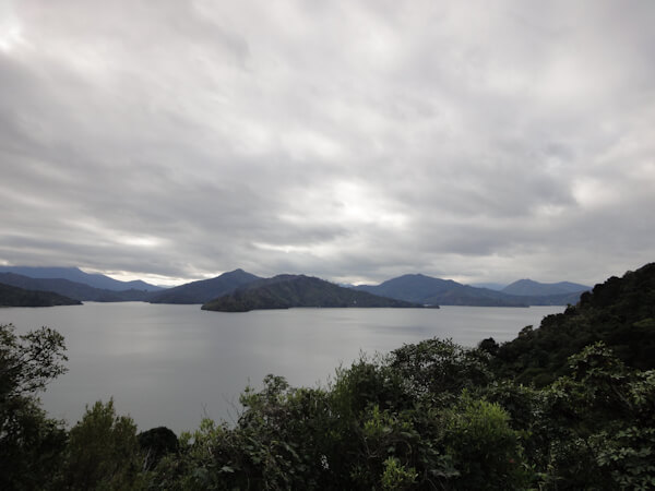
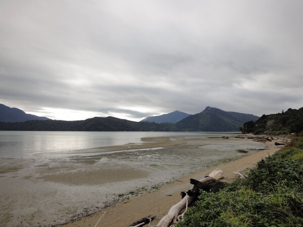
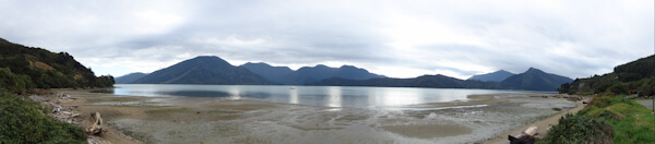
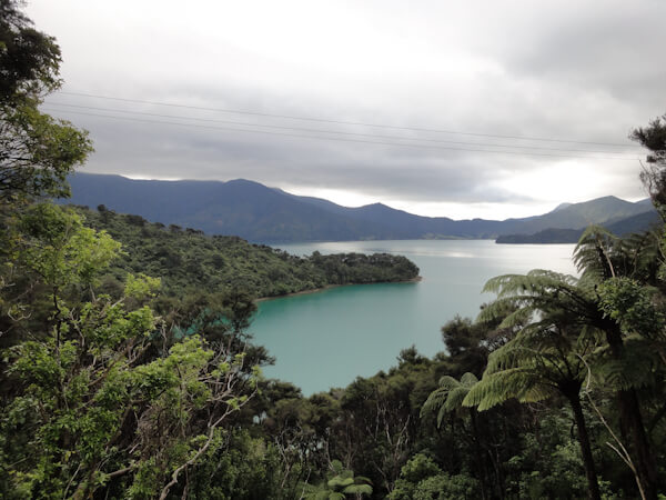
On the Inter-Islander ferry to the South Island we travelled through the scenic Marlborough Sounds. This is an inlet of many scenic coves and mountains known as sounds which as
a collective are referred to as the Marlborough Sounds. This led to some fantastic if cold views. Upon arriving on the land we took the high & windy scenic pass over and through
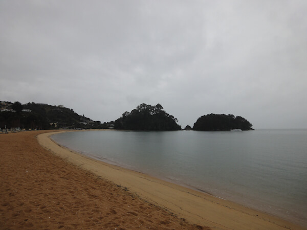
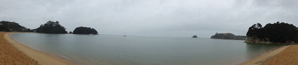
the sounds stopping off at some of the more accessible of them. Eventually we reached the town of Nelson where we spent a day exploring the nearby beaches of Kaiteriteria (the
most beautiful beach we found in New Zealand with turquoise waters), Patrons Rock & Pohara. We also stopped at the Te Waikorupupu Springs which supposedly contain the cleanest
fresh water in the world. You can supposedly see 63 metres through it underwater; unfortunately you aren't allowed to touch it for fear of contamination so we couldn't test this
theory.
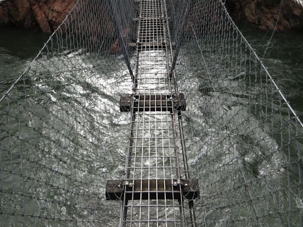
When we left Nelson on route to the West Coast we made a brief stop at the Buller gorge in order to witness New Zealand's longest swing bridge and so we could stretch our legs.
This was a very long bridge and gave nice views of the gorge and the surrounding area.
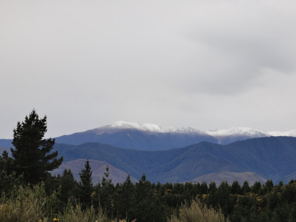
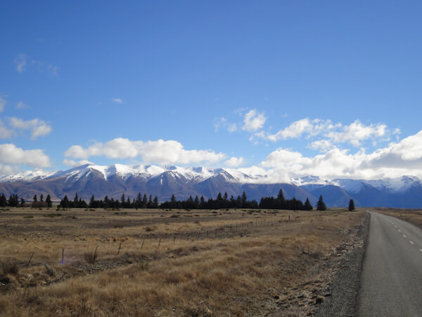
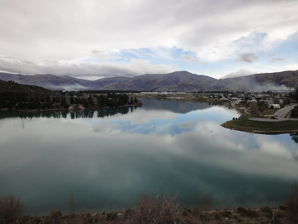
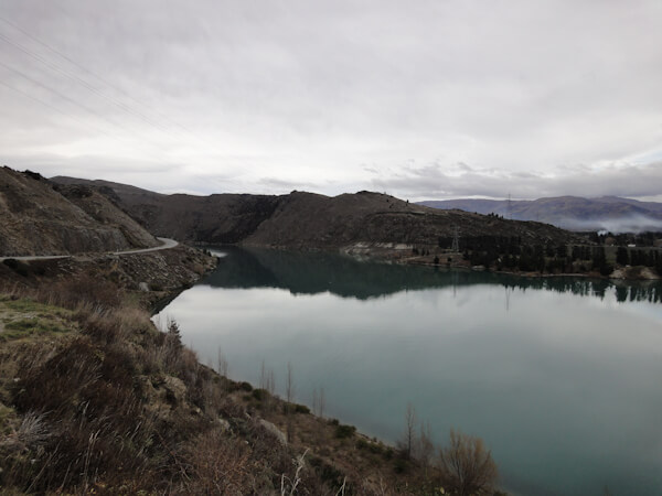
We also passed back through this region on the ending leg of our tour on the way to Christchurch. During this time we visited many alpine lakes which had beautiful snow-capped
mountains.
Our first stop on the West Coast was at Cape Foulwind. This was a lookout over the Tasman and home to New Zealand's largest fur seal colony.
Unfortunately we didn't manage to see any seals, but we did enjoy a nice lunch with great views from here. We then proceeeded to head south
down the west coast and eventually reached the Pancake Rocks, known as such because there appearance is similar to a stack of pancakes.
Scientists have no idea why the rocks have this appearance. While here we were also able to witness some awesome blowholes due to it being
high tide and the Tasman sea being so rough. We also headed into Punakiki cavern where we were able to explore the cave in darkness on our
own and witnessed a water- fall and the odd glowworm inside the cave.
While on the West Coast we visited Hokitika and enjoyed the beach here, a local glowworm dell where hundreds of glowworms live in a damp and
dark area of the rockface and the Hokitika Gorge which has the bright blue water which can be viewed from a suspension bridge. We were lucky
enough to stop here early in the morning and were therefore the only ones here in this beautiful place. If was difficult to access and only
local farmers live near it, but was certainly one of the best sights in New Zealand.
When leaving the West Coast we headed out via the Haast Pass through the Southern Alps and stopped at many Lakes, Waterfalls, Scenic Lookouts
and the supposedly blue "Blue Pools" which turned out to be more green than anything else.
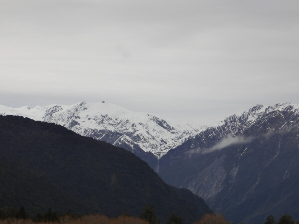
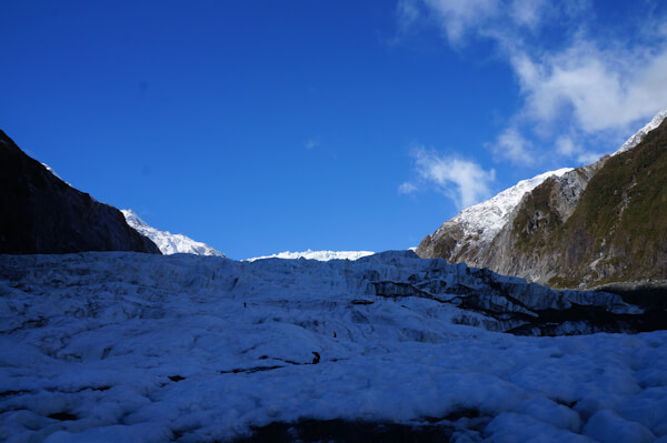
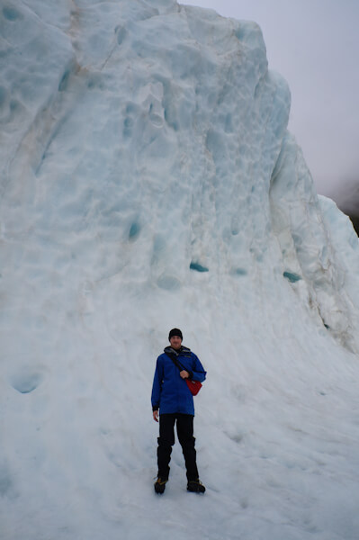
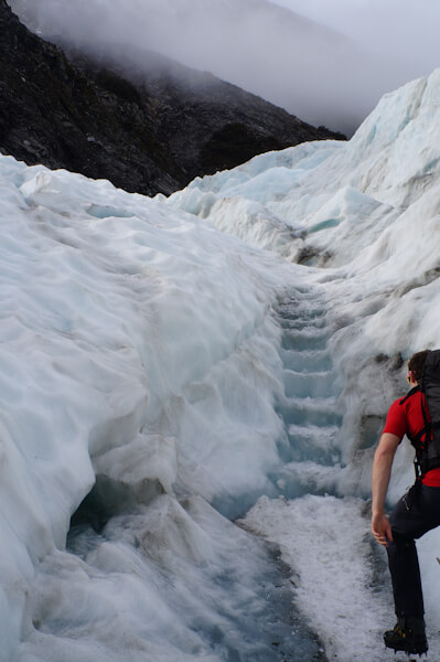
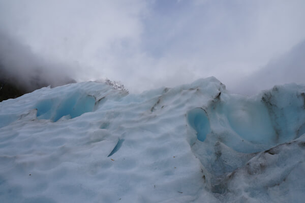
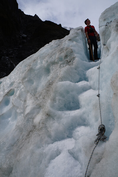
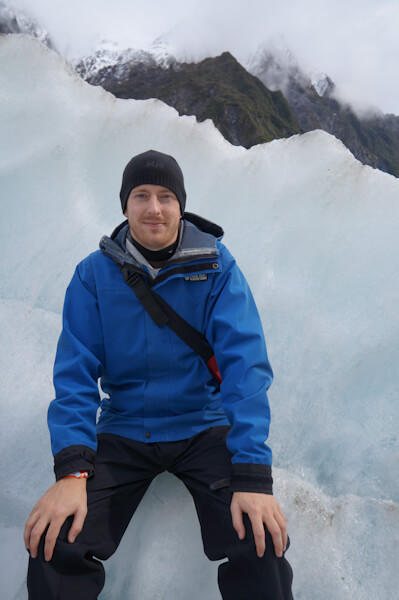
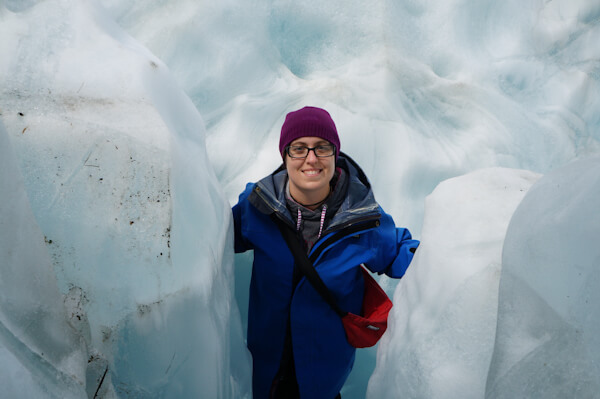
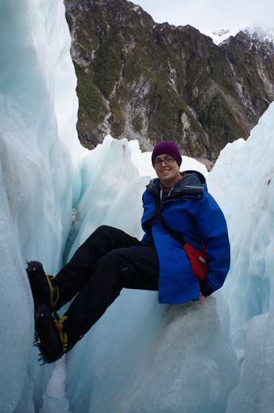
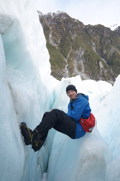
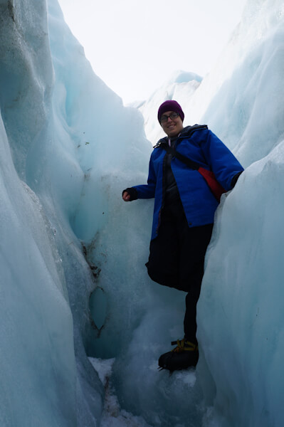
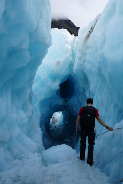
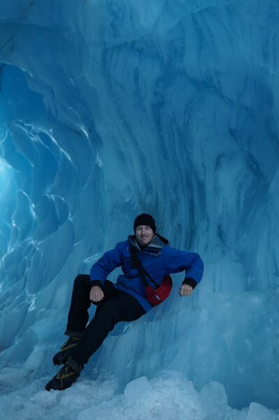
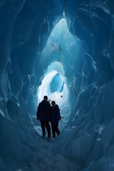
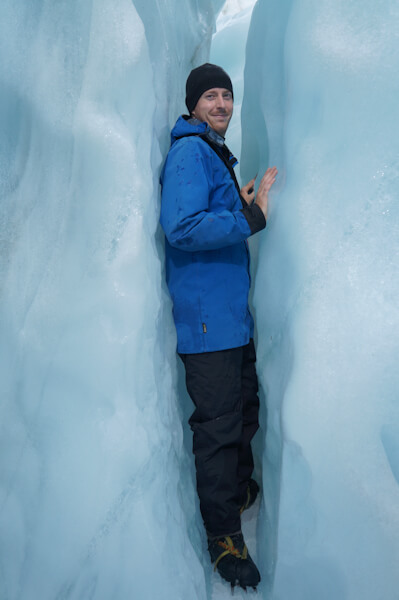
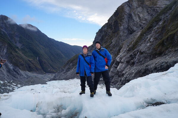
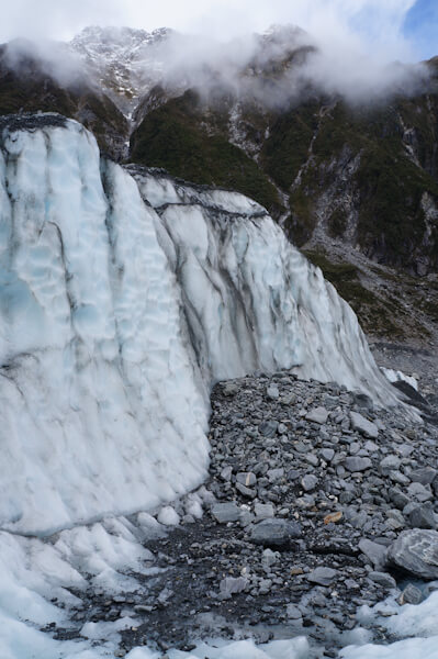
During our time in the Alpine township of Franz Josef we headed up onto the Franz Josef Glacier. This is one (along with Fox Glacier down the road) of only
a handful of glaciers which are actually growing rather than receding. This is down to the huge amounts of rain and snow that fall on the Southern Alps from
clouds having travelled over the Tasman Sea. We got onto the Glacier by taking a helicopter with 6 of us squeezed in. This was both of our first Helicopter
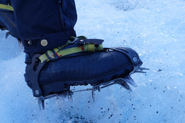
rides and Kat ended up getting the Co-Pilots seat. Once on the glacier we were provided with ice crampons (basically blades) in order to help us to walk on
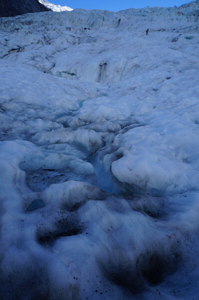
the ice. We then proceeded to hike for three hours up the face of the glacier over waves and crevices. Our guides helped out by cutting small steps in the
glacier where needed to assist us. During out time here we also had to squeeze between narrow cracks in the ice and head through a glacial tunnel deep within
the ice which turned out to be very slippery. Once we finished our hike we were taken back of the Glacier on a longer scenic helicopter ride.
We then spent the afternoon in the Glacier fed hot pools in order to soothe our muscles after lugging all the equipment around.
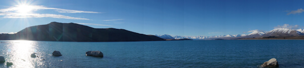
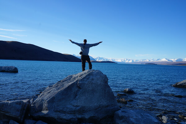
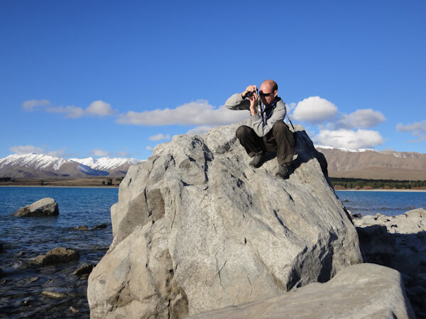
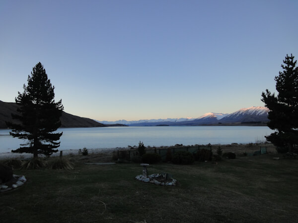
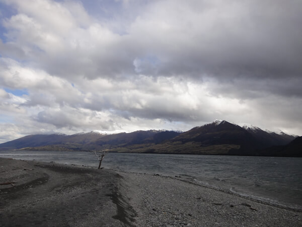
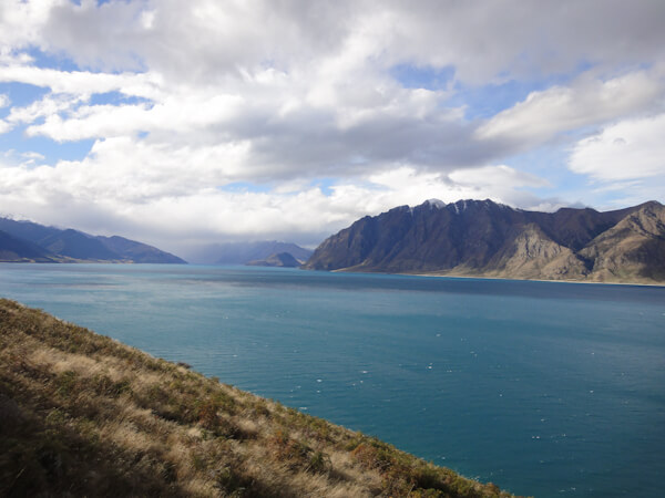
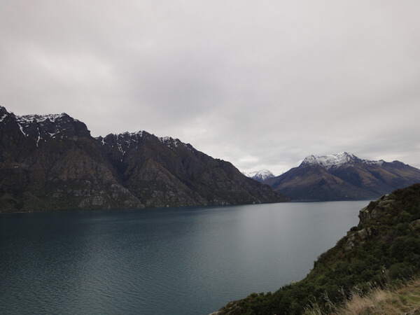
During our time in the southern region of the south island of New Zealand we visited Lake Wanaka, Lake Haewa and Lake Wakaitupu all of which were
beautiful spots with richly coloured water and had a backdrop of mountains with fresh snow-capped peaks.
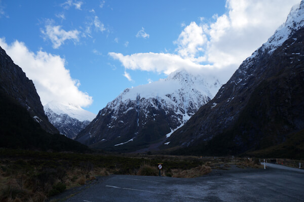
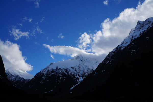
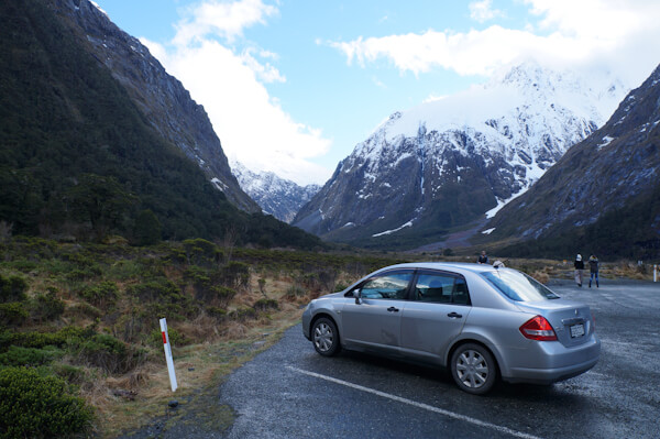
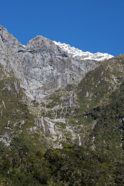
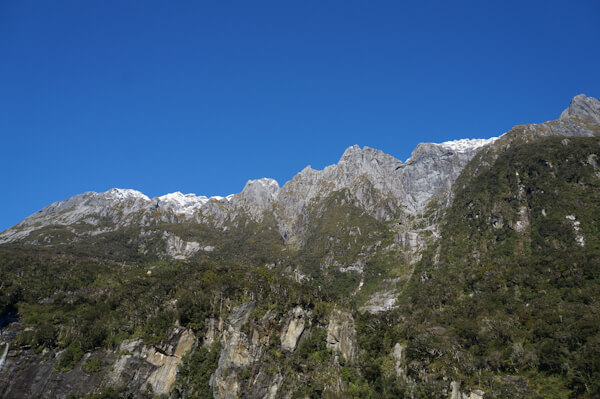
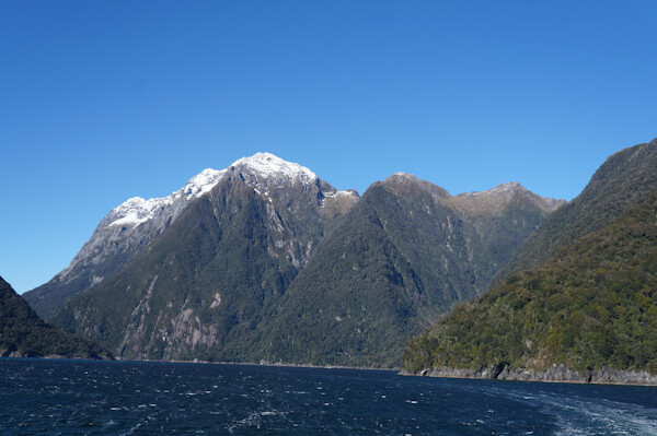
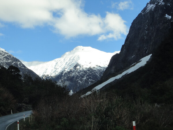
We also headed into the Fiordland National Park on route to Milford Sound were we had a boat trip planned. On our drive we headed onto one of the
steepest; if not the steepest sealed road in New Zealand. The road led us past several attractions on the way and resulted in us passing close by
many snow covered mountains, avalanches and beautiful forests. Being one of the first few cars that day to take the road we found the road slippery
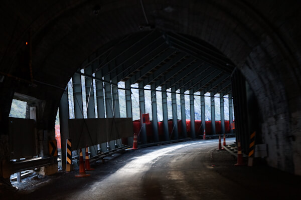
due to ice / grit. At one point the road passes through a 1.2km long tunnel boared through the mountain side in 1940 and it has a 1 in 10 gradient.
The tunnel has no lights, road markings and leaks. It is known as the Homer Tunnel. After passing through the tunnel it is a steep and windy overly
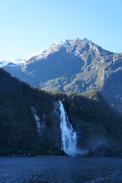
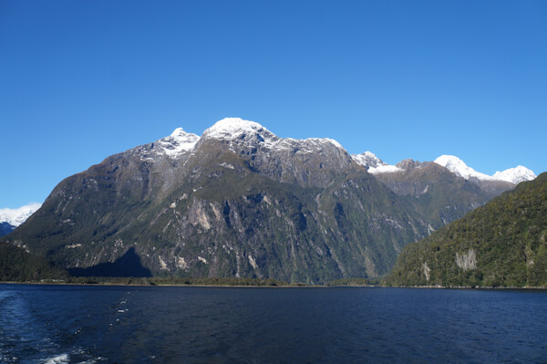
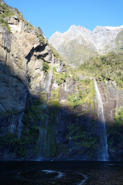
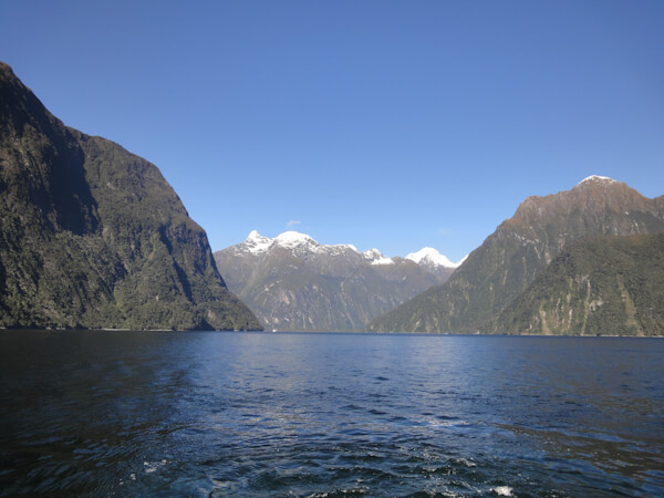
gritted descent into Milford Sound. Milford sound was formed by 5 glaciers craving out the area and then melting and feeding their water out into
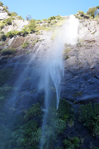
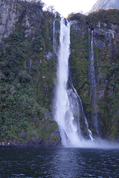
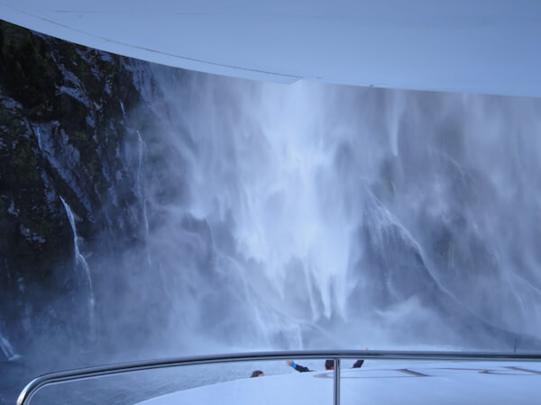
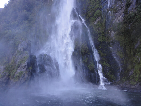
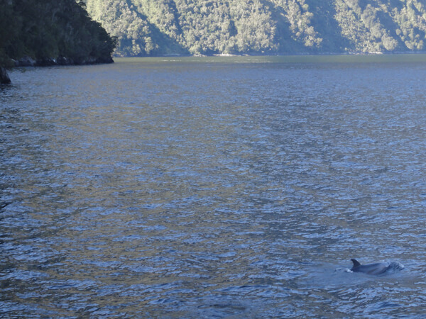
the Tasman Sea. During our time in Milford Sound we took a scenic cruise of the sound. This led to us seeing many magnificent peaks, waterfalls, fur
seals and bottlenose dolphins. The dolphins were playing with the boat and jumped into and out of the water using the boats wake. We also got in
really close to one of the waterfalls and we got absolutely drenched by the torrent of water and spray.
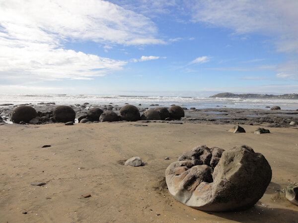
As we exited the Southern region we passed through several reflective lakes, the Otago Peninsula, nice beaches and the unique Moeraki Boulders. The
latter of which are large smooth round rocks found on the beach.
This point signifies the end of our tour of the South Island and thus New Zealand. We had covered 5,700km and seen more than we could've ever wished to see in winter. From here we caught a flight to Rarotonga in the Cook Islands and onto country number 16!
Next Page